
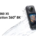
Integrating GPS data into your videos can turn a simple outing into an immersive experience. With the Insta360 X5, you can overlay your speed, altitude, GPS route or heart rate directly on your videos. Whether you’re a cyclist, biker, hiker, or just curious to track your rides, this data adds real value to your content. Here’s how to do it with devices like a Garmin, Apple Watch, or even without an external sensor.

Why add GPS data to your Insta360 videos?
- ⚡️ For outdoor sports: cycling, trail running, skiing, motorcycling, etc.
- 🌍 To geolocate and retrace your route
- 🎥 Enrich your videos with dynamic dashboards
- 🚀 To create more immersive content on YouTube, Strava, Komoot, etc.
- 🧠 To analyze your sports performance with accurate data
- 🤝 To make it easier to share with your community or sponsors

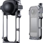
Insta360 GPS Remote Control Preview
Visit the Insta360 store
⭐ 4.3 out of 5 (406 reviews) – Amazon’s Pick
€173.99
Option 1: Connect a Garmin, Apple Watch, or COROS
The X5 is compatible with several sports tracking devices. These devices allow you to collect very precise data, which can then be added to your video footage.
📻 Compatible devices:
- Garmin (Edge, Forerunner, Fenix, etc.)
- Apple Watch (Series 3+)
- COROS
- IGPSPORT
✅ Does:
- Start your video recording with the X5
- Start activity recording on your watch at the same time
- Once the activity is complete, export the FIT or GPX file from the watch
- Open Insta360 Studio or the Insta360 mobile app
- Import your video and then add the FIT/GPX file to your clip
- Choose a dashboard from the options: speed, altitude, cardio, etc.
- Adjust the design and position of your data to match the style of your timeline
💡 Tip: You can synchronize the two recordings by aligning a key moment visible on the video (e.g., start, stop, sharp turn).
a:hover { transform: scale(1.05); } a[href*=”amazon”]:hover { background-color: #e68a00; } a[href*=”insta360″]:hover { background-color: #222222; } a[href*=”lacameraembarquee”]:hover { background-color: #0052a3; }
Option 2: Use the Insta360 GPS Remote
The GPS Preview remote control is a powerful accessory, especially for athletes. It allows you to:
- Control the camera remotely
- Have a live preview on your LCD screen
- Record GPS location accurately, even when the phone is not nearby
- Quickly activate a recording without touching the camera (practical on a bike or motorcycle)
Simply sync the remote control with the X5 before filming. Then, the Insta360 app will be able to automatically manage the data integration without complex manipulation.

Option 3: Add data directly from your smartphone
No watch? No problem. Your smartphone can do the job with the Insta360 app.
Steps:
- Activate your smartphone’s GPS
- Connect the X5 to the Insta360 app (Bluetooth + Wi-Fi)
- Start video recording from the Insta360 app
- The app will automatically record your phone’s GPS data
- When editing, you can integrate this data into videos from your phone or computer
👎 Limitation: the accuracy will depend on the GPS quality of your smartphone, and the battery life may be reduced if you use GPS continuously.
📈 Which dashboard to choose?
Here are the types of data you can include in your videos:
- Speed : km/h, mph, in evolutionary numerical or graphical form
- GPS map : superimposed route trace, convenient for viewing the path
- Altitude : useful in the mountains, trail running, cycling
- Cardio : Real-time heart rate (via compatible devices)
- Power : for riders with a power meter
Each overlay can be customized in Insta360 Studio:
- Colours
- Location
- Waist
- Units (Metric or Imperial)
🎥 Examples of inspiring uses
- 🚵 ♂️ Mountain bike video in the Alps with GPS track, speed curve, altitude and heart rate displayed
- 🏍️ Motorcycle ride with live speed overlay and dynamic map
- 🏃 Running outing with cardio + rhythm + speed in real time
- 🚴 YouTube videos “Cycling POV” with full dashboard like on pro videos
- 🧗 Technical hike with visualization of elevation and break times
🚀 To go further
- Use an Insta360 accessory like the helmet or handlebar mount to film your rides with stability
- Exports in 8K for maximum quality even with overlay
- Optimize your editing with ShotLab or Insta360 Studio (more than 30 effects available)
- Use the dashboard presets and create your own custom template
- Add your logo or channel name to overlays to reinforce your branding
With the Insta360 X5, integrating GPS data becomes child’s play, and a real plus for your outdoor videos. Whether you’re a content creator, athlete, or tech enthusiast, these features will allow you to take your adventures even further. Ready to document all your rides in style, with data to back it up?
❓ FAQ – How to integrate GPS data into your Insta360 X5 videos?
Why Add GPS Data to Insta360 X5 Video?
GPS data enriches your videos with information such as speed, altitude or route. This makes the content more immersive and useful for sports, storytelling, or sharing with your community.
Which devices are compatible to record GPS data?
The X5 can sync with Garmin watches, Apple Watch, COROS, IGPSPORT, the Insta360 GPS remote, or directly your smartphone.
How do I embed a GPX or FIT file in a video?
You can import your videos into Insta360 Studio or the mobile app, then add the GPX/FIT file to sync the GPS data with your footage.
Can I use a smartphone instead of a GPS watch or remote control?
Yes, through the Insta360 app, your smartphone records GPS data during video capture. However, be careful with the precision, which varies depending on the model.
What types of data can be displayed as an overlay?
Speed, altitude, GPS track, heart rate, power (cycling), etc. All of these are customizable in Insta360 Studio.
Should I use Insta360 Studio to add GPS data?
This is recommended for more control over the overlays. But the mobile app also allows you to do it quickly and intuitively.


Leave a Reply